
Trace a South Brunswick Street
A South Brunswick street search works best as a parcel walk. Start with the current, standardized address and establish the physical parcel before reading names from other records. The tax proof book, tax maps, statewide parcel tools, and county GIS are useful at different points. A street name can be broad near community and post-office boundaries. The stronger key pairs the address with South Brunswick Township and parcel identifiers.
- Find the address in the South Brunswick tax-map system, the annual proof book, or NJ Property Explorer. Record the block, lot, qualifier when shown, and physical property address.
- Open the same property in the Middlesex public parcel layer. Save the PAMS_PIN, a county parcel identifier, along with deed book/page values, sale date, and the map position of nearby parcels.
- Use the owner name, municipality, block, and lot in the County Clerk BrowserView search. A deed establishes a recorded transfer, not present occupancy.
- For an earlier transfer, search the latest grantor, the deed’s seller, as an earlier grantee, the buyer on a prior deed. Carry the legal description forward and check spelling variants.
- Use the individual NJ Voter Search only to check a specific registration. It is not a public all-street roster. Historical directories are a separate, older source.
That sequence relies on published fields and prevents an owner mailing address from being mistaken for a household address.
Normalize South Brunswick Street Addresses
Use the street number, road name, municipality, and a current postal form before beginning a South Brunswick street directory search. Government systems often use “South Brunswick Township,” while mail may use Dayton, Kendall Park, Kingston, Monmouth Junction, Princeton, Cranbury, East Brunswick, Jamesburg, or North Brunswick. A post-office city is a delivery label, not proof of the township that holds the parcel. The USPS ZIP Code Lookup can standardize an exact mailing address, while the tax map and GIS municipal field identify the public-property geography.
Older records need a wider set of terms. South Brunswick’s five communities, Route 27, Route 1, rail-linked Monmouth Junction, and postwar Kendall Park belong to different address eras. Cranbury changes in 1872 and 1885, followed by Plainsboro’s 1919 separation, mean an old deed or directory can use another township context. No official South Brunswick street-number renumbering year was located. Search old road and post-office aliases instead of assuming a modern number was always used.
Note: A ZIP label can help deliver mail, but the tax map and parcel municipality are the better tests for a South Brunswick property.
South Brunswick Street Directory Property Fields
The 2025 South Brunswick tax proof book shows why a street directory needs more than a name. A row separates the owner and owner mailing address from the property location, called the situs. It also supplies a block, lot, land description, class, ZIP, zoning or tax-map reference, assessment fields, and exemption indicators. A public body, company, trustee, or owner outside the township may receive the bill. That mailing line is useful for understanding tax responsibility, but it does not establish who is living at the South Brunswick address.
- Parcel
- A defined piece of land recorded in the tax and map system, commonly identified here by block and lot.
- Situs address
- The physical property location. It can have a different postal city or ZIP from the owner’s mailing address.
- Plat or tax map
- A mapped parcel reference showing roads, block and lot patterns, and the relevant map sheet.
- Criss-cross directory
- A historical directory arranged by address or street rather than only by a person’s name.
The South Brunswick Assessor keeps the tax-map and assessment route at 540 Ridge Road. Mark Fitzpatrick is listed at extension 7232 and Marie DoStasio at extension 7242; the office is available by appointment on weekdays from 8:30 a.m. to 4:30 p.m. The proof book and assessor counter are the documented channels when no public owner-name form is available.
Browse South Brunswick Streets in GIS
The Middlesex parcel layer is the most practical way to scan a South Brunswick road parcel by parcel. GIS means geographic information system, a map-based record layer. Click a polygon, pan along the road, or use a query instead of treating a name search as a street list. The layer has polygon geometry and supports map clicks, spatial queries, query-with-distance, pagination, and up to 2,000 records in one response. County metadata says the parcel data updates monthly from municipal MOD-IV property-assessment data, so note the update fields when a date matters.
The Middlesex public parcel-layer metadata identifies the South Brunswick fields that make the map useful for an address trail.
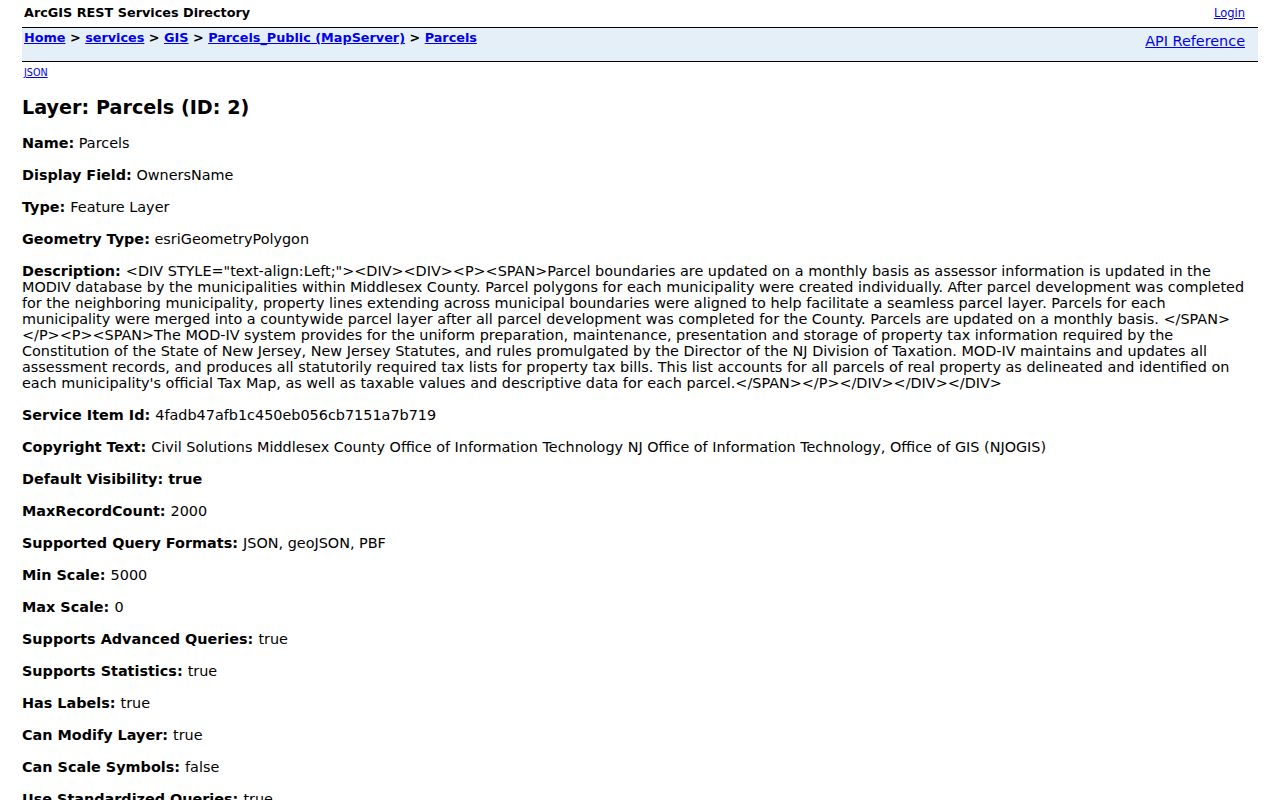
PAMS_PIN, MUN, BLOCK, LOT, PropLoc, OwnerAddr1, OwnerAddr2, ZipCode, SalesDate, DeedBook, DeedPage, SalePrice, Acreage, YearBuilt, and SFLA connect a mapped parcel to later record searches. A name display can be subject to Daniel’s Law protection, so an absent name is not a reason to guess.
Use the map for comparison, not title conclusions. Parcel geometry, street location, and the field values help identify which deed to inspect. The Clerk’s recorded instrument remains the place to verify a transfer.
Carry South Brunswick Parcel Keys
Block, lot, and PAMS_PIN are more durable than a road name. A parcel can gain a new lot number or qualifier after a subdivision, and a deed may use metes and bounds, easements, or a reference to an earlier instrument. Keep the legal description and current deed book/page with the street address. That small record set lets a South Brunswick researcher move between the tax map, GIS layer, County Clerk index, and a targeted request without relying on a possibly repeated street name.
| GIS field or key | What it identifies | Use in a street search |
|---|---|---|
| PAMS_PIN / UNIQUEID | County parcel identifier | Separates one mapped parcel from a similar street address. |
| BLOCK / LOT / QCODE | Tax-map parcel reference | Links the assessor’s tax data to the Clerk’s lot/block search. |
| PropLoc / ZipCode | Property location and mail-area field | Checks situs against the delivery label without treating the ZIP as a boundary. |
| DeedBook / DeedPage | Recorded-document reference | Points to the transfer that should be reviewed in BrowserView. |
| LASTUPDATE / LastUpdate_M4 | Layer freshness fields | Shows when to date a GIS observation before comparing it with older records. |
Save the keys and GIS-view date to find the same South Brunswick parcel when a tax layer changes.
South Brunswick Street Directory Deed Chain
Once the parcel keys are known, the Middlesex BrowserView index can be searched by party, instrument number, book/page, town, lot/block, legal description, map number, parcel ID, document type, date range, or consideration. The page displays a CAPTCHA before search. Enter South Brunswick as the town and use block/lot or book/page when a party name is broad. The county advises users to try spelling variations, which is especially important for a grantor-grantee chain.
BrowserView’s search controls show the address-independent keys that can carry a South Brunswick street trail into recorded land documents.
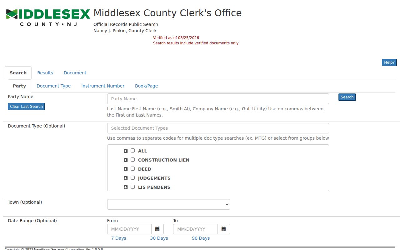
Start with the most recent grantee or the known book/page. Read the grantor, grantee, recording date, consideration, legal description, and prior-deed reference. Then search the grantor as an earlier grantee. Deeds are explicitly stated online from 1929, while a 2022 county announcement describes digitization to 1923. Check a particular year with the Clerk rather than treating those two statements as the same cutoff.
For earlier material, the County Clerk’s books and public search room remain part of the bridge. The New Jersey State Archives holds county-deed microfilm through 1900, while the originals remain county property. Carry the legal description across that handoff.
South Brunswick Address Record Coverage
A South Brunswick street directory can combine several address-keyed sources, but each source answers a narrower question. The proof book identifies assessed ownership and situs. GIS adds parcel geometry and related fields. Deeds document recorded transfers. The voter tool is an individual registration check, not a public street list. Building records can date work at a parcel, while older reverse directories can place a household or business in a directory year when the volume supports that index.
| Address-keyed source | Custodian | What it can show | Access channel |
|---|---|---|---|
| Tax proof book and tax maps | South Brunswick Assessor and Planning | Owner, mailing address, situs, ZIP, block/lot, tax-map reference, and assessment fields | Proof-book PDF, 205 map sheets, or assessor counter |
| Public parcel layer | Middlesex County GIS | Parcel polygons, PIN, property location, owner-address fields, sale/deed fields, acreage, year built, and SFLA | Public map and REST layer, updated monthly |
| Recorded land documents | Middlesex County Clerk | Grantor/grantee, legal description, consideration, recording date, and book/page or instrument | BrowserView, Clerk records, books, and microfilm |
| Tax search | South Brunswick Tax Collector | Tax quarters, tax-sale status, added or omitted assessment, rollback, improvements, and water or sewer status | Written form, one form per block/lot |
| Permits and code records | South Brunswick Building and Planning | Construction, inspection, certificate, or code timing where releasable | Counter or specific OPRA request |
| Historical reverse directories | South Brunswick Public Library and regional holders | Address or place-indexed occupants and businesses when a volume includes them | Archive visit and regional directory volumes |
The County Clerk’s deed index, the assessor’s parcel materials, and the map layer are the main current record chain. A tax record or an owner mailing field does not supply a complete list of occupants along a South Brunswick street.
South Brunswick Street Permit Fallback
The South Brunswick Building Department administers construction permits, inspections, and related records. Its files may place an alteration, inspection, certificate, applicant, or contractor at an address, but they are not a public resident roll. No public permit-by-address portal was located. The supported route is the Building counter or a focused request identifying the street address, block/lot, permit type, and date range. Questions about resale certificates of occupancy belong with Planning and Zoning rather than Building.
A request under the South Brunswick Open Public Records Act process, usually called OPRA, should identify the record and the correct custodian. It can be submitted in person, by mail, fax, or electronic method. The township says records that need compilation or copying generally receive a response within seven business days after a complete request reaches the proper custodian. Ask for a defined record series rather than an unsupported request for everyone on a road.
Note: Permit and code files can establish property activity and timing, but they do not establish a complete history of people at an address.
South Brunswick Street Geography
Street research has to account for South Brunswick’s geography. Dayton and Deans retain older rural and road history. Monmouth Junction grew around rail connections and has its own post-office identity. Kingston lies near the Princeton edge, and Kendall Park reflects postwar planned development. A South Brunswick street directory search can therefore require both a modern subdivision name and older road, village, or post-office terms. The township’s present boundaries date to 1919, after Cranbury and Plainsboro changes, so a pre-1919 record may describe a broader or different municipal setting.
Route 27 followed an older corridor, Route 1 was the Straight Turnpike built in 1804, and the New Jersey Turnpike opened in 1951. Those transport names can be valuable context in maps, deeds, and local history. They are not replacements for a parcel key. When an address becomes a historical question, the South Brunswick Directory Book has the regional directory path rather than a modern property search.
South Brunswick Street Directory Sources
Historical reverse or criss-cross directories are regional tools, not a continuous South Brunswick household list. The located 1890 New Brunswick directory has a South Brunswick section, and the New Jersey State Library bibliography identifies Polk and Richmond regional runs from 1928 through listed volumes in 1980. Inclusion varies by volume. The South Brunswick Public Library local-history archive is the practical starting point for the 1890 section, local-name files, obituaries, historical houses, and a research appointment.
NJ Property Explorer accepts address, county, municipality, block, and lot rather than promising a dedicated owner-name mode.
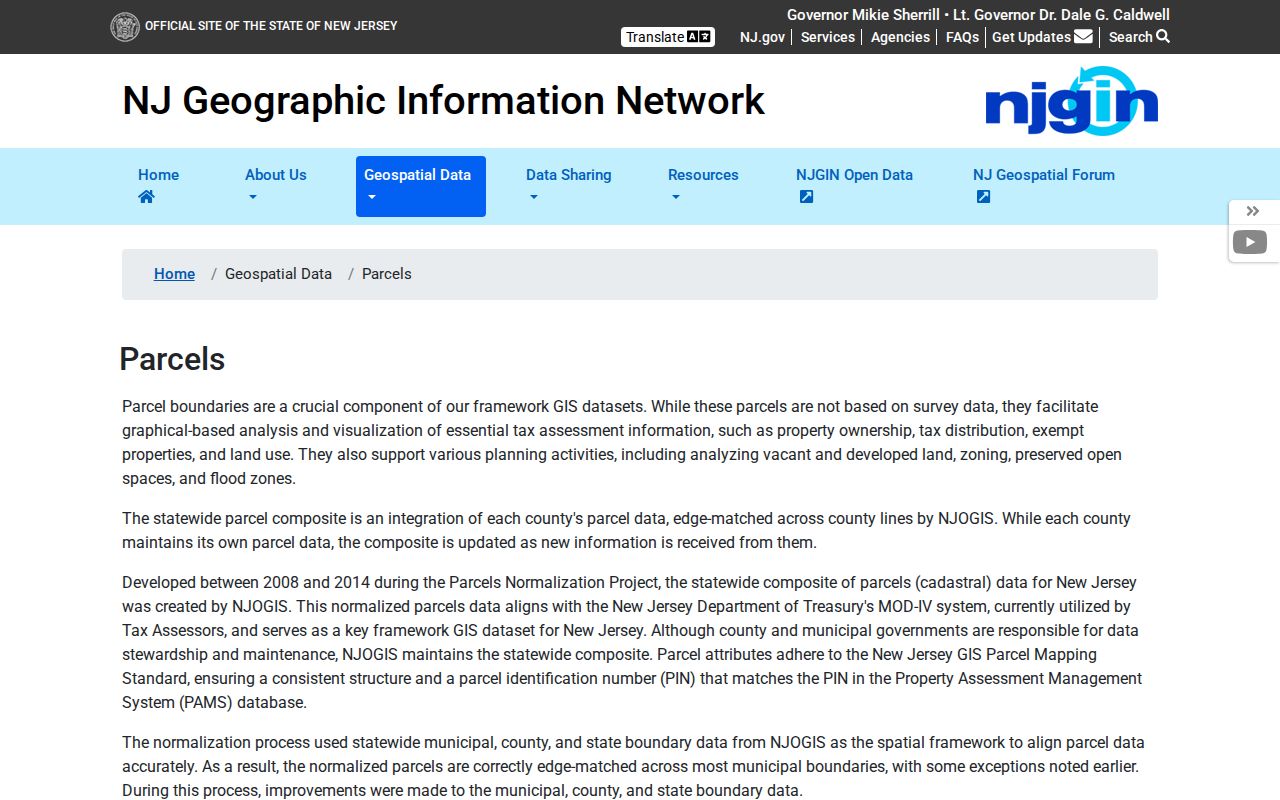
Use the address or block-and-lot result to establish the modern parcel, then preserve the legal description when moving to older material. The county map and tax data update over time; an older directory or deed has to be read in the record context of its own year.
South Brunswick Street Lookup Boundaries
Property records identify tax responsibility and recorded land activity. They do not prove who currently occupies every parcel. A relative or other household member may not appear in the assessor, deed, or directory material. The state’s voter tool is individual, not a public by-street list. DMV personal address data is restricted, utility customer lists are not a public resident directory, and protected voters or covered persons can have omitted or substitute address information through the Address Confidentiality Program and Daniel’s Law.
Lawful use. Use South Brunswick address records for a specific lawful purpose. Do not use them to stalk, harass, threaten, or intimidate another person.
A missing field is a limit, not an invitation to fill it in from unrelated sources. Confirm a record with the office that maintains it, and treat a property owner, a mailing address, and a resident as distinct facts.